Visitor information for West Cape Howe National Park Map
West Cape Howe National Park Map is a beautiful destination in Albany WA:
West Cape Howe Map of Attractions and Places to Visit Visit West Cape Howe National Park Map
CLICK HERE FOR DETAILS ON West Cape Howe National Park Map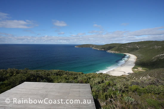
Frequently Asked Questions about West Cape Howe National Park Map:
Question: Where is West Cape Howe National Park Map located?
Answer: West Cape Howe National Park Map is located near Albany Western Australia. Albany is on the south coast of Western Australia. Use your GPS and go directly to this Latitude: -35.094069 and Longitude: 117.599030 in Western Australia - on the South Coast of Western Australia.
Get Directions (Google Maps)Get Directions (Apple Maps)
Open in Waze
Question: What is the weather like at West Cape Howe National Park Map?
Question: Where can I find out more about West Cape Howe National Park Map?
Answer: Details, including photographs and more can be found here West Cape Howe National Park Map.